Brave Puffin September 2026 update
Busy summer: two Brave Puffin boats, multiple launches, one attempt in progress
Highlights:
The new 2026 single motor, rudder-based Puffin performed well in multiple overnight autonomous tests, was launched into the Gulf of Maine, malfunctioned, drifted for ~2 months while being passively tracked, and… keep reading.
Last year’s 2025 two motor, thrust steering Puffin was promptly refurbished and also launched into the Gulf of Maine. And:
Did you know that tidal currents in the Gulf of Maine are off the charts crazy, some of the strongest on the planet? I didn’t.
So 2025 Puffin was brought back after 3 weeks in the gulf, inspected, upgraded, and launched onto a proper west-to-east Microtransat mission, on a different route; it is in progress!
2026 Puffin
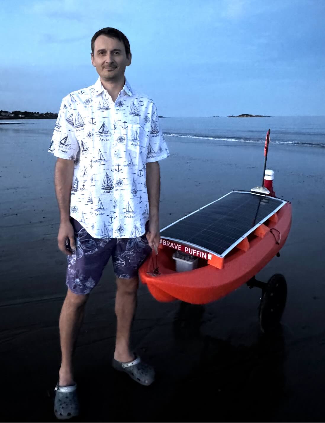
I enjoyed building and testing this boat. It has a robust and efficient hull with an oversized rudder, a wind sensor and a mast for future upgrades; yet it is light and compact.
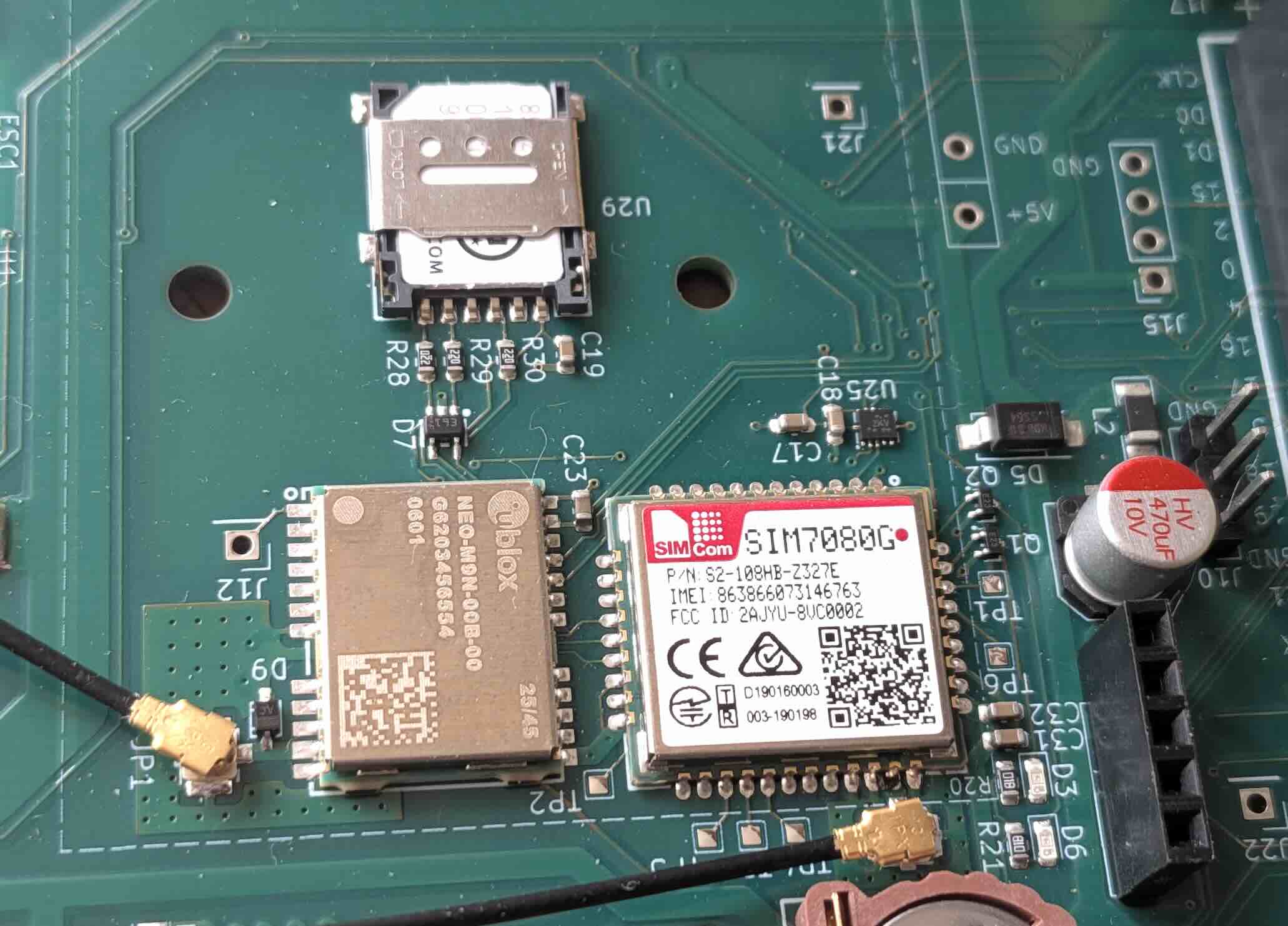
It has many electronics upgrades on a custom-designed PCB, including an LTE (cell) modem for frequent communication during near-shore test missions and over-the-air firmware upgrades:
Launched it on July 18th:
And promptly lost control the next day. I think it capsized (long story).
Thankfully, I installed a battery-powered backup satellite tracker, gimbal-mounted, i.e. always pointing up, even if the boat is inverted. You can see its dedicated enclosure in the picture above, peeking from under the solar panel.
So, I could still track the boat. It would phone home via Iridium occasionally, but otherwise it was totally drifting, making some strange art over the next 2 months:
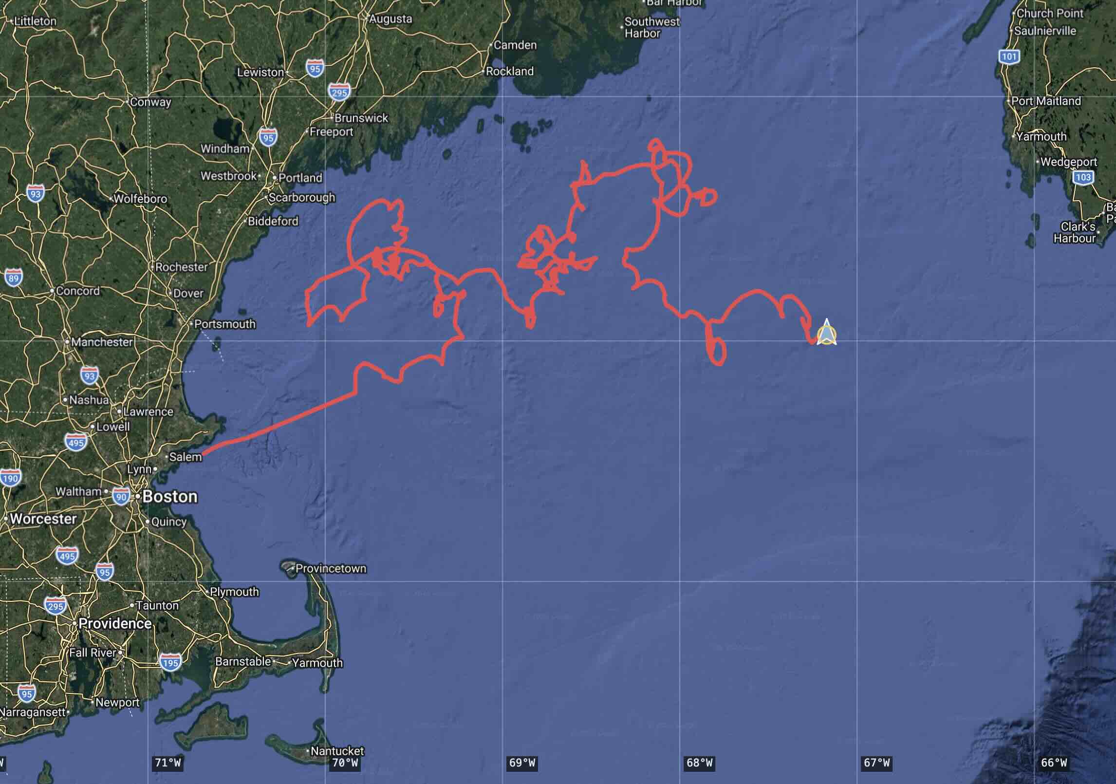
Until a few days ago, when I got a message from someone on a Canadian fishing boat. They found it and brought it on board!
They are still offshore. We agreed to talk in a couple of weeks to facilitate the pickup. Can’t wait to read the logs and inspect the boat - yes, it was a failed mission, but I am sure I’ll learn a lot from it.
2025 Puffin on a 2026 mission
Undeterred, I took the old 2025 boat, refurbished and upgraded it, tested it near shore and launched it within a week. That became a 3-week, 1180 km (640 nautical miles) roundtrip shakedown mission. You can see that initially it was mostly following the route and going straight. Then, about 65 km off the coast of Nova Scotia, things got strange. The boat would not make any progress, despite seemingly favorable conditions:
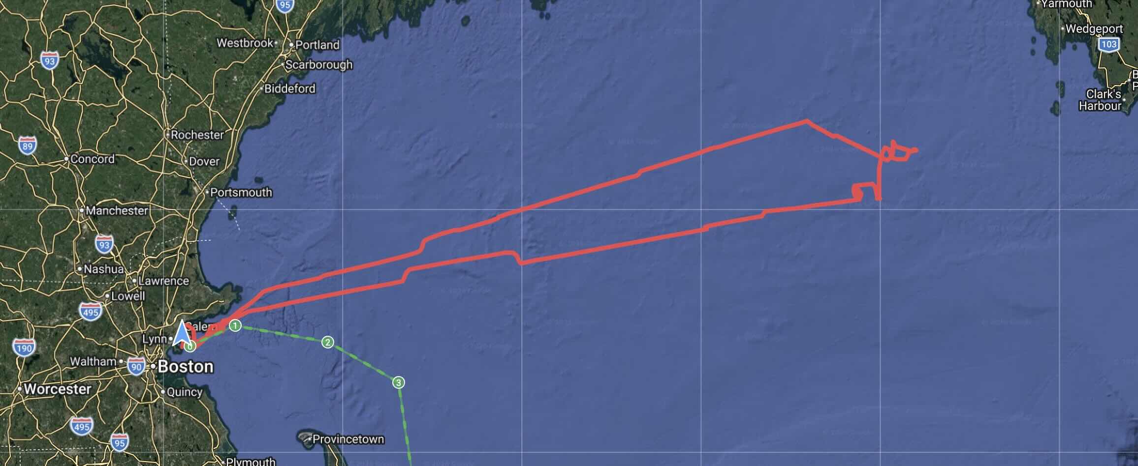
Well, that was me learning the hard way that the tidal currents there are nothing like what we have here in Boston. They can reach and exceed 5 knots (i.e. 9 km/h) or so in some areas, and, naturally, the currents change direction multiple times a day:
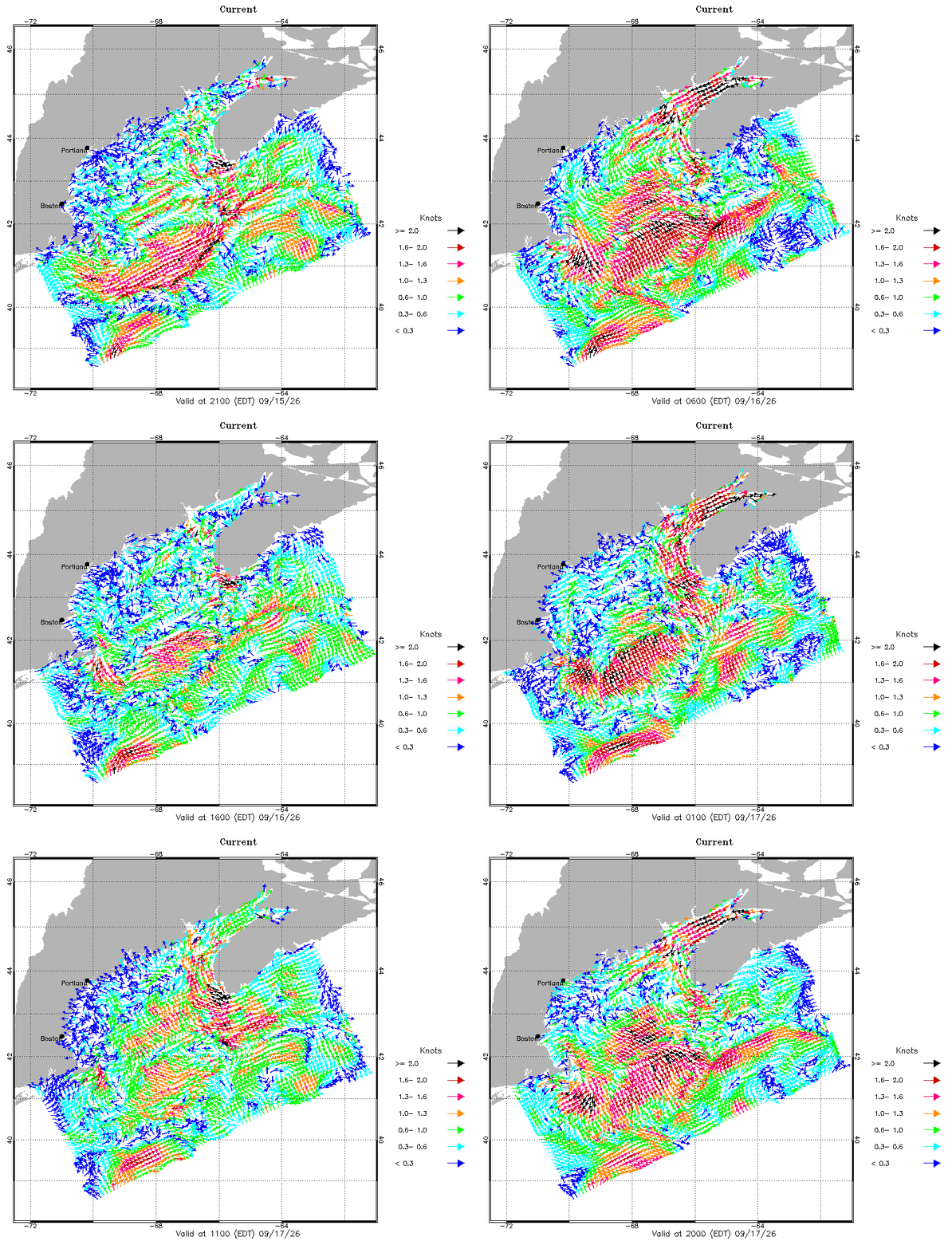
Meanwhile, the maximum speed that the 2025 model can do, fully charged and at max power, is about 4 km/h. I simply could not route the boat through! Plus, the main satellite (Iridium) communication was spotty. I turned the boat around, and successfully retrieved it in late August.
Transatlantic attempt
Launching a solar boat across the ocean in early September means there’s not going to be as much sunlight available. Especially on the shortest possible, northern route. My simulation showed it’s just not going to be enough, and the boat will start drifting every day. (Sad, because my original route was aiming for Puffin Island.)
Thus, to get more sun and to benefit from the Gulf Stream, Brave Puffin is now going south, from Boston to the Canary Islands:
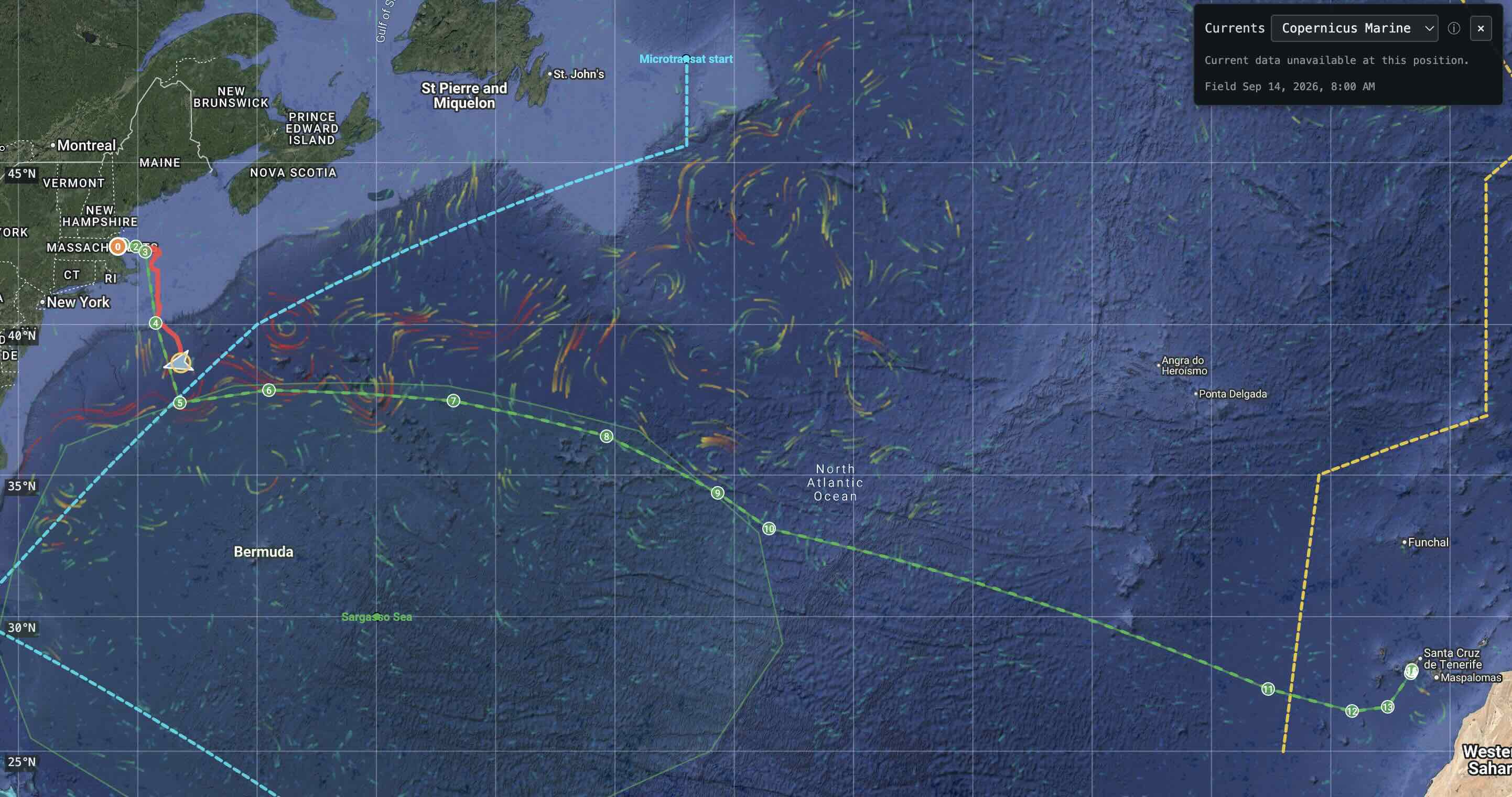
What you see on this ^ map:
- The long green line is the intended route, featuring major waypoints
- The short red line on the left is Puffin’s track so far, between August 29th and September 15th, as of this writing
- It is roughly south of Cape Cod and at the latitude of Washington DC, after completing ~800 km so far
- It entered the Gulf Stream and is about to cross Microtransat’s starting (blue) line
- It has a long way to go to the (yellow) finish line: 5000 km remaining; it will take 3-4 months if all goes well
- This is not the shortest route: my intent was to “punch through” tidal currents, tap into the Gulf Stream, and avoid the Sargasso Sea
- The swirly colored lines show major currents; they are animated on my map; can cover next time
Stay tuned
This is getting quite long already. Hopefully Puffin will keep on going, so I’ll have more opportunities to share its progress and the lessons learned, such as:
- Solving the prop fouling problem
- Dealing with ocean currents and the weather
- Sensor data (e.g. water temp) vs. oceanic models
- Choosing and using ultrasonic wind sensors
- Selecting LTE and Iridium antennas
- …or what else would you like me to cover?
Comments
Loading comments…
Comments are closed.